F58_HV 2018 August 24 754_V2.jpg
Victor van Katwijk

Interested?

HR Victor_van_Katwijk

If you’re interested in a demo or would like to know more, Please contact Victor van Katwijk.

Email me

One team, one map, the same information

The Netherlands is slowly filling up, which means that designing and drawing up new plans is becoming increasingly difficult. That’s why we created Phoenix, a touch table application that provides all stakeholders with a shared overview of the situation. This makes it easier to balance everyone’s interests, both in the preparation phase and during the actual planning phase. From farms that have to make way for a highway or extra wind turbines to provide more sustainable energy, Phoenix will help you come to the right decision together.

Paper becomes digital

People who have worked for the (local) government for long enough should be familiar with this: large paper maps that teams spend the entire day working on. Outdated, perhaps? Paper maps are often no longer current, they are subjected to many a coffee spill and they are prone to inaccuracies. Phoenix is completely digital. This is a touch-table application that the whole team can use simultaneously. The handy functionalities let you add or remove items yourself, such as a new road or wind turbine. Easy, all it takes is the touch of a button. You can control and view various 2D and 3D map layers together, so that you can better balance the interests of the various team members and reach a more widely supported decision.

All information at a glance.

When you’re working on an issue with a team, it’s helpful if everyone has the same information. Phoenix ensures just that. Thanks to Geodan’s data tools, the map of your area is filled with a wide range of information, from zoning plan to aerial photos and social media messages with your hashtag of choice. All this information can easily be linked to your map. And best of all? Phoenix calculates whether an idea is really feasible. It will show you how many houses will be affected by noise or end up hidden in the shadow of a new building at a glance.

Pros

Why Phoenix?

  • Effective cooperation

    Effective cooperation on spatial issues
  • Immediate calculations

    Immediate feasibility calculations
  • One handy map

    All information on one handy map
  • User-friendly interface

    Working with a user-friendly interface

Easy interface

We spent a lot of time making the interface as user-friendly as possible. Just like on paper, you can draw the borders of your area. Place wind turbines where they’re needed or simply move an object you had already added to the map. Thanks to handy symbols, you can take clear notes. Phoenix also calculates dimensions and distances in an instant, so you don’t have to. Done planning? Simply export the map to any file format you want. Easy to share and discuss!

System.NullReferenceException: Object reference not set to an instance of an object.
   at ASP._Page_Views_Widgets_WidgetProductDemo_cshtml.Execute() in C:\home\site\wwwroot\Views\Widgets\WidgetProductDemo.cshtml:line 42
   at System.Web.WebPages.WebPageBase.ExecutePageHierarchy()
   at System.Web.Mvc.WebViewPage.ExecutePageHierarchy()
   at System.Web.WebPages.WebPageBase.ExecutePageHierarchy(WebPageContext pageContext, TextWriter writer, WebPageRenderingBase startPage)
   at Umbraco.Web.Mvc.ProfilingView.Render(ViewContext viewContext, TextWriter writer)
   at System.Web.Mvc.Html.PartialExtensions.Partial(HtmlHelper htmlHelper, String partialViewName, Object model, ViewDataDictionary viewData)
   at Our.Umbraco.DocTypeGridEditor.Web.Extensions.HtmlHelperExtensions.RenderDocTypeGridEditorItem(HtmlHelper helper, IPublishedElement content, String editorAlias, String viewPath, String previewViewPath, Boolean isPreview)
   at ASP._Page_app_plugins_doctypegrideditor_render_DocTypeGridEditor_cshtml.Execute() in C:\home\site\wwwroot\app_plugins\doctypegrideditor\render\DocTypeGridEditor.cshtml:line 28
   at System.Web.WebPages.WebPageBase.ExecutePageHierarchy()
   at System.Web.Mvc.WebViewPage.ExecutePageHierarchy()
   at System.Web.WebPages.WebPageBase.ExecutePageHierarchy(WebPageContext pageContext, TextWriter writer, WebPageRenderingBase startPage)
   at Umbraco.Web.Mvc.ProfilingView.Render(ViewContext viewContext, TextWriter writer)
   at System.Web.Mvc.Html.PartialExtensions.Partial(HtmlHelper htmlHelper, String partialViewName, Object model, ViewDataDictionary viewData)
   at ASP._Page_Views_Partials_Grid_Nexwork_Base_cshtml.Execute() in C:\home\site\wwwroot\Views\Partials\Grid\Nexwork\Base.cshtml:line 21
Case:

A clear look ahead with real-time data

Large events at the Johan Cruijff Arena draw ten thousands of visitors. The nearby concert halls also regularly draw large crowds. How do you direct all of that traffic? It starts with monitoring. Real-time information about the situation on the road helps.


case - Visualisatie Arena 2d.jpg
Products and services

Solutions

Geodan offers handy tools for the local government sector.

All products
Our datasets and services offer all sorts of valuable information, ranging from insight into the number of stories in a building to predicting stop times.
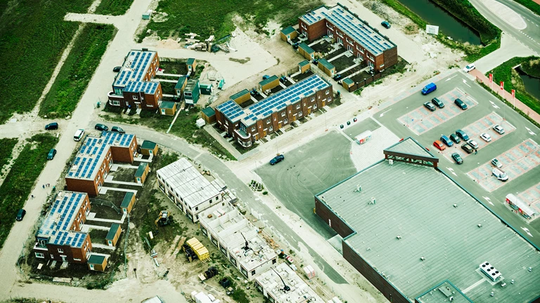
A Digital Twin is a digital replica of reality. By combining several datasets, an increasingly better picture of the environment emerges in the Digital Twin. You can develop plans that appeal to as many stakeholders as possible and that can be tested by various target groups.